Exploring Southwark and discovering its history
 Search


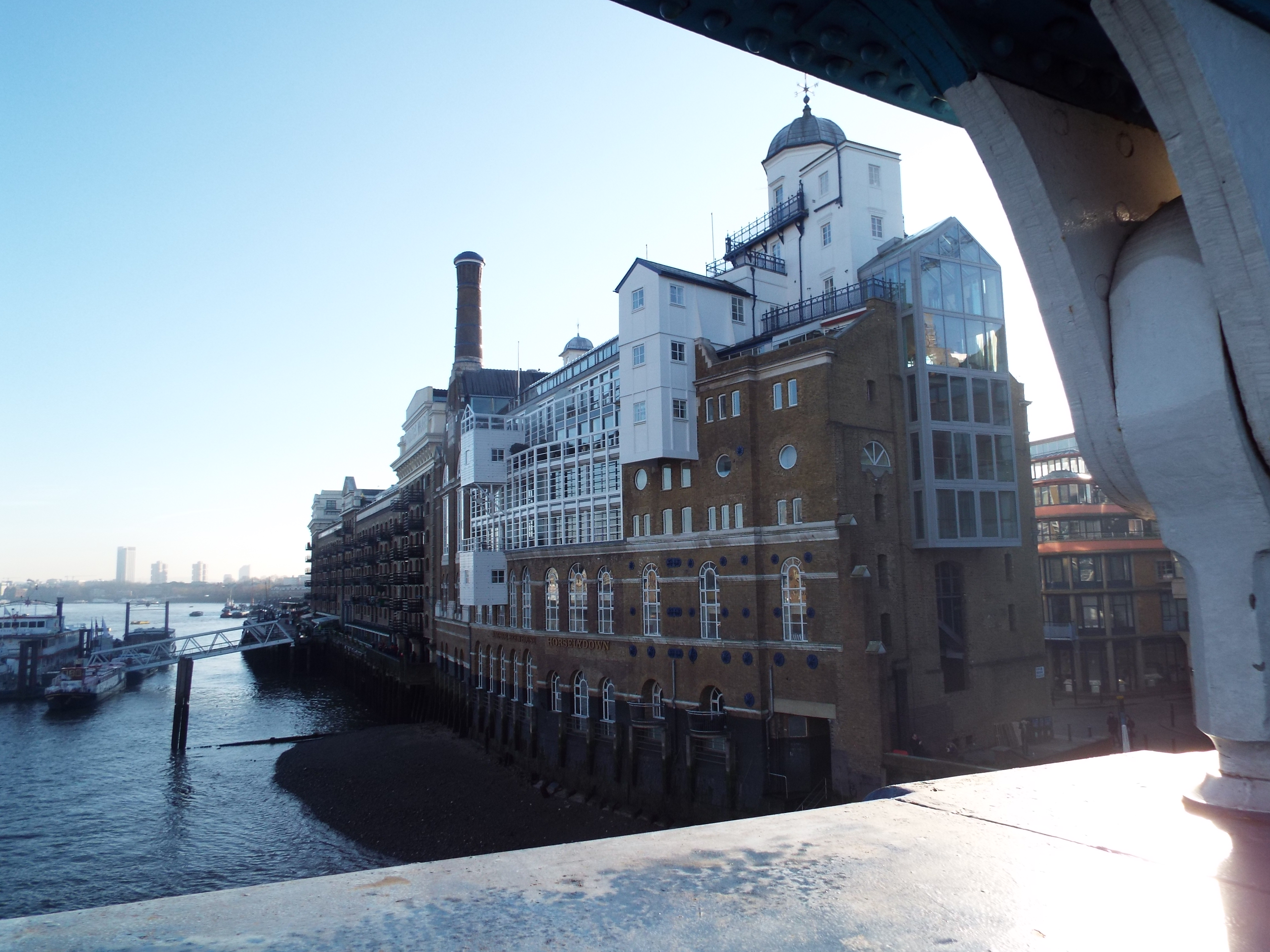
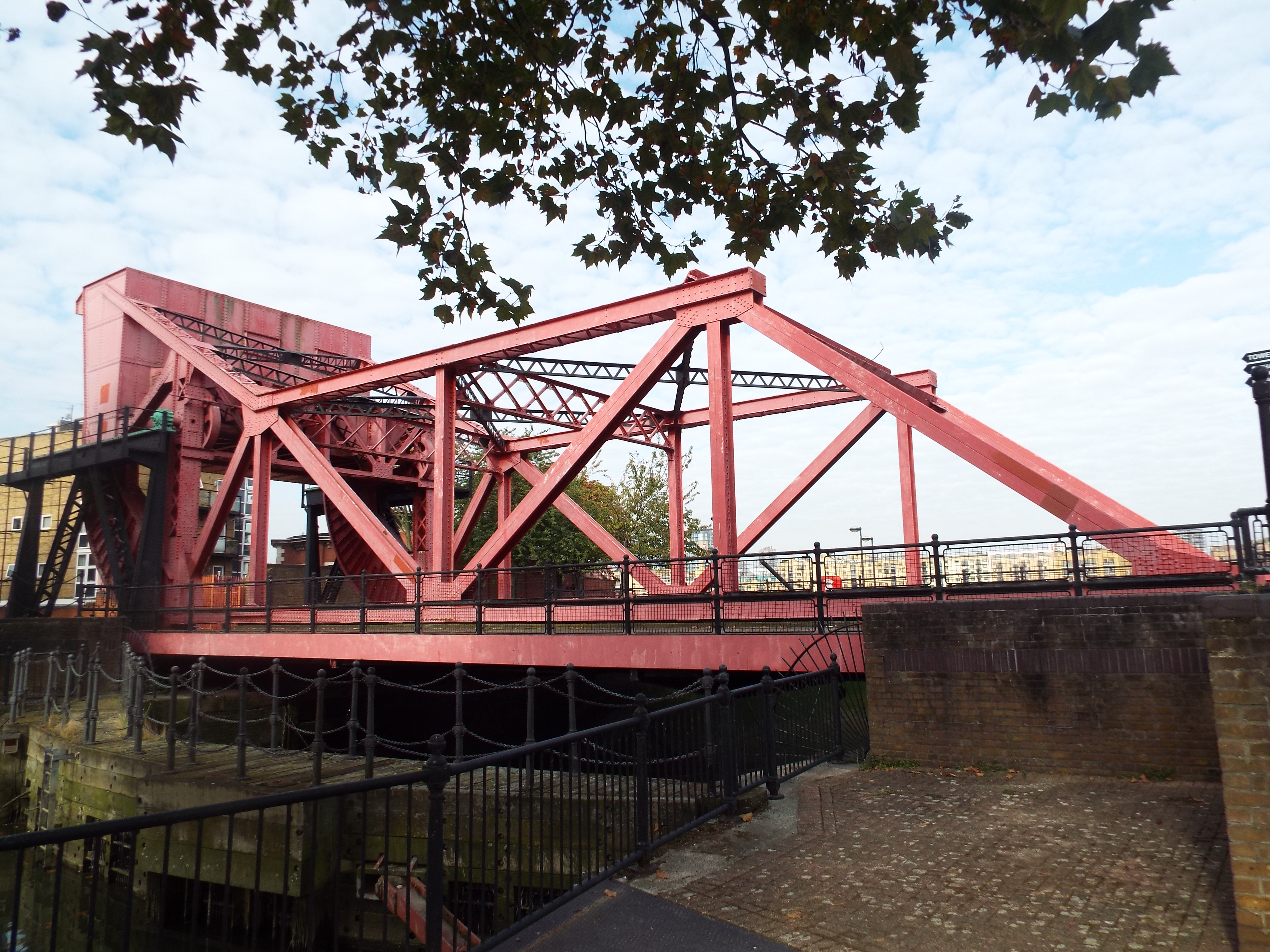
St Saviour's Dock and Jacob's Island
Walking over the bridge at the mouth of St Saviour’s dock is like being transported to another age when the Victorian wharves were bustling and prosperous and when the river was noisy and crowded with ships unloading cargoes from all over the world. Today it’s a pleasant place for a stroll or a peaceful place to live, only a stone’s thrown from the City of London.
The bridge crosses over the mouth of the river Neckinger, one of London’s “lost rivers” that has now mostly disappeared. The area of Bermondsey fronting on to the river consisted of marshland interspersed with channels of water that filled and emptied with the ebb and flow of the tidal Thames so it’s possible the River Neckinger was a water channel like a ditch rather than a running river. The name Neckinger is thought to be a derivation of the “Devil’s Neckerchief”, the hangman’s noose, as a gibbet used to hang pirates once stood at the mouth of the river. The channel ran from around where the Imperial War Museum stands today, around the Elephant and Castle, through Bermondsey Square and through to the Thames here at St Saviour's Dock.
Bermondsey Abbey, dedicated to St Saviour, was built in 1082 and was a part of the French Abbey at Cluny. Bermondsey Square covers a large part of where the Abbey once stood and it’s possible to see some of the Abbey masonry through a glass floor in the Del’Aziz restaurant. The monks of the Abbey reclaimed and drained the land around the outflow of the Neckinger while embanking and enlarging the main outflow to form St Saviour’s Dock and built a windmill next to it for grinding corn which was powered by the ebb and flow of the tidal Thames. The Abbey closed at the time of the Dissolution of Monasteries and was handed over to Henry VII in 1539.
Over the next 200 years, the area became a thriving manufacturing area as factory owners were attracted to the proximity of the river for the transportation of both raw materials and finished goods. In particular it was a popular area for the processing of food and the area became known as the Larder of London. Tanning, an overwhelmingly smelly and noxious industry that necessitated the use of both urine and dogs' faeces, was a prohibited industry within the City of London and moved to Bermondsey where the water of the Neckinger was used for some of its processes.
St Saviour’s Dock declined and other ditches appeared that became open sewers filled with filth, putrefaction and squalor, the detritus of manufacturing processes. The infamous Jacob’s Island evolved just to the east of St Saviour's Dock. Built on marshland and cut off by foul water-filled ditches, it was bordered by what are today Mill Street, Bermondsey Wall West, George Row and Wolsley Street. The area contained some low quality warehousing one of which was home to Fagin’s Den in Oliver Twist by Charles Dickens who describes Jacob’s Island vividly:
"A stranger, standing on one of the wooden bridges thrown across this ditch in Mill Street, will see the inhabitants of the houses on either side lowering, from their back doors and windows, buckets, pails, and domestic utensils in which to haul the water up; and when his eye is turned from these operations to the houses themselves, his utmost astonishment will be excited by the scene before him. Crazy wooden galleries, common to the backs of half-a-dozen houses, with holes from whence to look on the slime beneath; windows, broken and patched, with poles thrust out on which to dry the linen that is never there; rooms so small, so filthy, so confined, that the air would seem too tainted even for the dirt and squalor which they shelter; wooden chambers thrusting themselves out above the mud, and threatening to fall into it, as some of them have done; dirt-besmeared walls and decaying foundations … warehouses are roofless and empty, the walls are crumbling down, the windows are now no windows, the doors are falling into the street, the chimneys are blackened, but they yield no smoke; and, through losses and Chancery suits, it is made quite a desolate island indeed."
Jacob’s Island was described as the “Capital of Cholera” and the “Venice of Drains”, and many of its inhabitants died in the cholera epidemics of 1849 and 1854. Jacob’s Island began to be levelled not long afterwards as the causes of cholera were beginning to be understood and the area drained, properly embanked and more solid warehouses built.
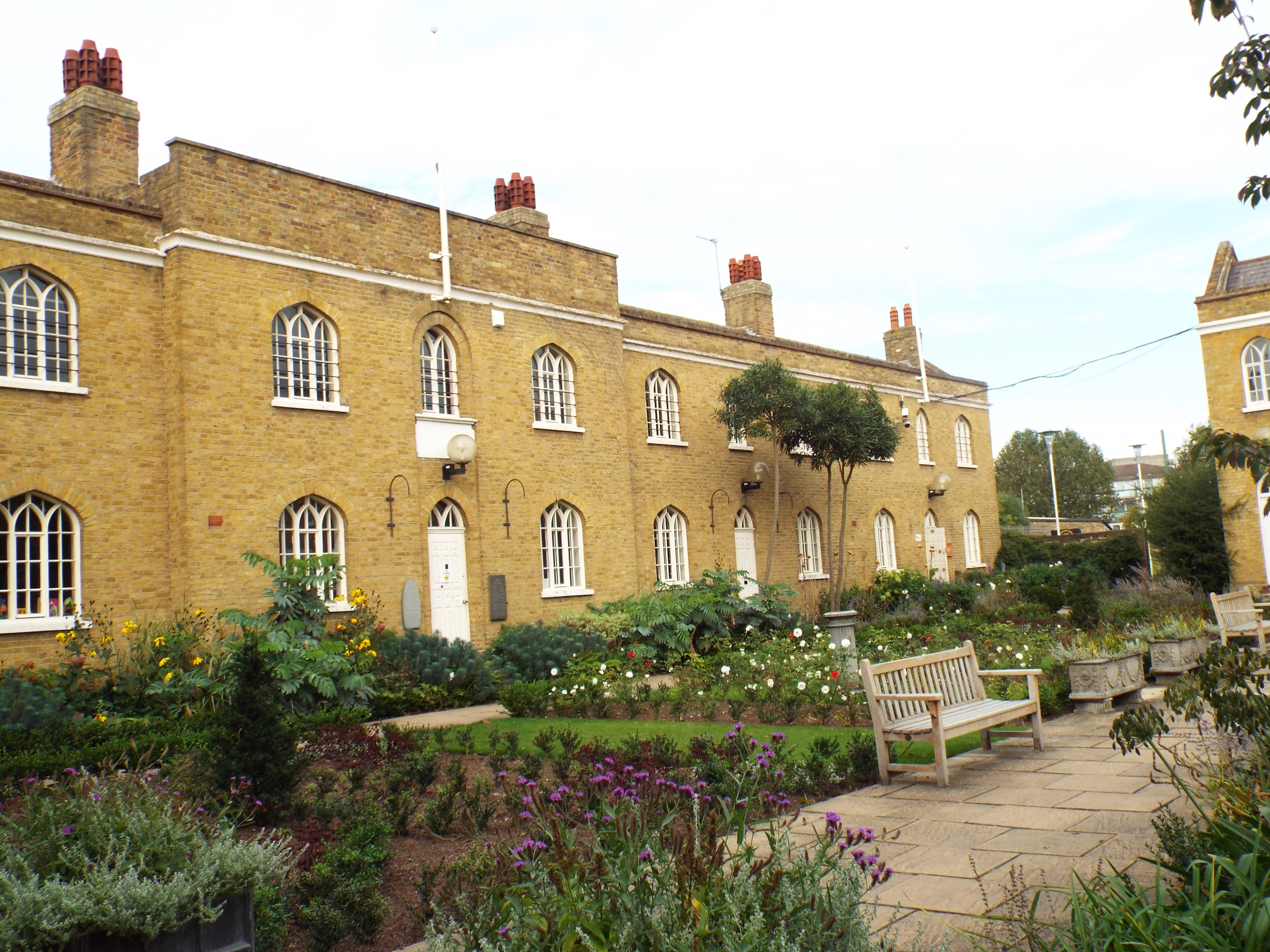
Jacob’s Island was badly bombed during World War II. Development of Providence Square, the current estate, began in the 1990s and took its name from Providence Buildings which had been part of the rookery in Victorian times and described by Henry Mayhew in 1849 as a narrow neck of land set in sewers.
New Concordia Wharf, one of the imposing buildings that fronts onto St Saviour’s Dock, was built to store grain in 1885 and named after a town called Concordia in Kansas which was the source of large quantities of imported grain. Later in the twentieth century the warehouse were used for a greater variety of goods. The Inner London Docks, including St Saviour’s Dock, closed in the 1960s with the introduction of containerisation and New Concordia Wharf fell into disuse. Andrew Wadsworth bought the building in 1980 and successfully restored and refurbished the building to become a mixed use development containing 60 flats, studio workshops, office space, a restaurant, communal space and an underground car park. Grade II listed in 1982, it was a very successful warehouse conversion and the first of many such conversions that followed on both sides of the river.