Exploring Southwark and discovering its history


Latest Pages
Park Street, Bankside
Park Street extends from Borough Market in the east to close by the Tate Modern in the West, lying in between the River Thames and Southwark Street. It was named after the park that surrounded Winchester Palace which the street bordered but this was a 19th century renaming and rebranding exercise. The streets origins are a lot more earthy and reflect Bankside’s reputation for fun, entertainment, bawdiness and licentiousness, for its playhouses, taverns and its brothels.
Most of the street today is lined with post-war buildings but the easternmost section of the street running from Borough Market to where Paul Smith’s shop is now located is the oldest part with many early Victorian houses and shops surviving. This section was once called Dirty Lane* and it can only be imagined and shudder as to how it got that name. It is proposed to revive the street name for a new pedestrian route to be called Dirty Lane, just north of the original, in redevelopment plans for the former Vinopolis site.
The road then turns north towards the river. This section was originally called Deadman’s Place, some say after the large numbers of plague victims that were buried there. It was later the site of Cure’s College, perhaps the earliest almshouses in St Saviour’s parish. Thomas Cure was saddler to Queen Elizabeth I, and a driving force in the setting up St Saviour’s Grammar School. Cure's College was built in 1584 as stipulated in Thomas Cure’s will for 16 poor parishioners of St Saviour's who also received a small weekly sum.
The land was compulsorily purchased in 1863 by the Charing Cross Railway Company to make way for the London Bridge to Charing Cross extension and new almshouses built, at the railway company's expense, in Norwood. The remaining land was integrated into the Barclay Perkins Brewery. By 1814 Deadman’s Place had been renamed Park Street.
The continuation to the north of this section of Park Street becomes Bank End and Park Street continues along a turning to the left. The rest of Park Street to the west was once named Maid Lane, named after the women who, in one sense of the word, were certainly no maids. It was the location of the Bankside Stews, the medieval brothels that faced onto the river with gardens that led down to Maid Lane. By 1850, Maid Lane had been renamed to become a continuation of Park Street, probably a Victorian reaction to obliterate any connection to vice.
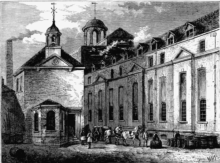
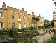
The brewery was demolished in 1981 and the social housing estate built. Some early Victorian houses still remain, built by the brewery to house their most senior employees, most notably the one at no. 23 with the well known painted sign ‘Take Courage’ on the side which in latter years were owned by Southwark Council and the cause of controversy sold into private ownership.
The road follows around a 1980s low rise social housing estate and a small road built on the estate has been named Maiden Lane. The estate was built on land formerly occupied by the Anchor Brewery / Barclay Perkins Brewery / Courage Brewery which once dominated the area and at one time the largest brewery in the world. The area was very different then with the noise, the dirt, the industrial buildings and the smell of the brewery making for a very different environment.
A high wall ran around the brewery and, just before the road runs under Southwark Bridge Road, a plaque was mounted onto the wall 1909, marking the site thought to be the location of the original Globe Theatre. There was a dispute whether this was in fact the actual site or whether in fact the original Globe had been sited on the north side of Park Street. Since then, in 1989, archaeological excavations have confirmed the site to have been on the brewery’s land. The plaque still remains, and the site of the original Globe Theatre is now a cobble stoned car park.
Passing under Southwark Bridge, on the other side of the road by the side of an entrance to an anonymous-looking late 20th century building, is a blue plaque marking The Rose Theatre, the first of the Bankside playhouses. The foundations of the Rose Theatre were discovered in 1989 during routine archaeological works after clearing the site of a 1950s block in preparation for a new development. The developers wished to go ahead with the new build but a high profile campaign was launched to save the foundations. In the end a compromise was reached and the new build was suspended over the foundations of the Rose allowing for further archaeology and viewing by the general public.
A turning further on towards the river called Bear Gardens is a reminder of the cruel sport of bear and dog-baiting offered as Tudor entertainment. The remains of three bear gardens were discovered in 1995 as a result of archaeological investigation, together with the remains of The Hope, another of the Bankside playhouses.
By the 19th century, the north side of Park Street had become industrialised with warehouses and engineering, a sheet lead manufacturer, a wheelwright and a cold storage facility among the concerns at the end of the century. Today, the section leading to Sumner Street where the road ends is dominated by a variety of large, post World War II buildings, including a substantial building located behind the new Shakespeare’s Globe forming a part of the theatre’s complex. Although a modern building, its origins reflect the history of Park Street, but perhaps a pale shadow of Bankside as it was in the times of the original Globe Theatre.
*There was another street of the same name further west which now forms part of Great Suffolk Street.
Web discoveries
- UK Casino Not On Gamstop
- UK Casino Not On Gamstop
- Non Gamstop Casino
- Casinos Not On Gamstop
- Non Gamstop Casinos
- Non Gamstop Casinos
- Non Gamstop Casino
- Casinos Not On Gamstop
- Casino Sites Not On Gamstop
- Slots Not On Gamstop
- Casinos Not On Gamstop
- UK Betting Sites Not On Gamstop
- UK Casino Not On Gamstop
- Best Non Gamstop Casinos
- Betting Sites
- Non Gamstop Casino Sites UK
- Best Non Gamstop Casinos
- Non Gamstop Casino
- Casinos Not On Gamstop
- Non Gamstop Casino Sites UK
- Horse Racing Betting